![](/images/other/stat-length.png)
![Randonnée A pied Telve di Sopra - Sentiero di Spiado e Sentiero del Salubio - Photo](https://media.geolcdn.com/t/1900/400/a4c9065b-55f1-490b-8c59-3906918246b0.jpeg&format=pjpeg&maxdim=2)
Sentiero di Spiado e Sentiero del Salubio
SityTrail - itinéraires balisés pédestres
Tous les sentiers balisés d’Europe GUIDE+
![Longueur](/images/other/stat-length.png)
Longueur
7,9 km
![Altitude max](https://static1.geolcdn.com/siteimages/upload/files/1508320355ic_sort_altitude_max_24dp.png)
Altitude max
1847 m
![Dénivelé positif](https://static1.geolcdn.com/siteimages/upload/files/1508320355ic_sort_den_pos_24dp.png)
Dénivelé positif
339 m
![Km-Effort](/images/other/stat-length.png)
Km-Effort
13,1 km
![Altitude min](https://static1.geolcdn.com/siteimages/upload/files/1508320355ic_sort_altitude_min_24dp.png)
Altitude min
1392 m
![Dénivelé négatif](https://static1.geolcdn.com/siteimages/upload/files/1508320355ic_sort_den_neg_24dp.png)
Dénivelé négatif
535 m
![Boucle](https://static1.geolcdn.com/siteimages/upload/files/16400158638029165_repeat_loop_refresh_sync_direction_icon.png)
Boucle
Non
Balise
Date de création :
2022-02-15 07:47:36.947
Dernière modification :
2022-03-01 06:24:25.988
![A pied](https://static1.geolcdn.com/sitytour/trail-icons/100.png)
2h58
Difficulté : Facile
![Scannez ce code QR pour ouvrir la randonnée dans l'application SityTrail](https://capi.geolives.com/qq0zvz2zws4bq2lad0pu/sitytour/trails/3117019/qr.png?size=200)
Application GPS de randonnée GRATUITE
À propos
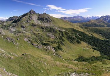
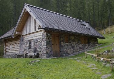
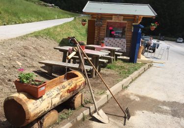
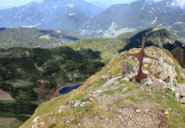
Randonnée A pied de 7,9 km à découvrir à Trentin-Haut-Adige, Provincia di Trento, Telve di Sopra. Cette randonnée est proposée par SityTrail - itinéraires balisés pédestres.
Description
Randonnée créée par Società degli Alpinisti Tridentini.
Site web: http://www.sat.tn.it/
Localisation
Pays :
Italie
Région :
Trentin-Haut-Adige
Département/Province :
Provincia di Trento
Commune :
Telve di Sopra
Localité :
Unknown
Départ:(Dec)
Départ:(UTM)
688767 ; 5110632 (32T) N.
Commentaires
Randonnées à proximité
![Randonnée A pied Palù del Fersina - Palai en Bersntol - IT-E324 - Photo](https://media.geolcdn.com/t/375/260/469455af-86d0-437e-84be-18d3142dda85.jpeg&format=jpg&maxdim=2)
![A pied A pied](https://static1.geolcdn.com/sitytour/trail-icons/100.png)
IT-E324
A pied
Facile
Palù del Fersina - Palai en Bersntol,
Trentin-Haut-Adige,
Provincia di Trento,
Italie
![](/images/other/stat-length.png)
6,3 km | 10,8 km-effort
2h 27min
![](https://static1.geolcdn.com/siteimages/upload/files/16400158638029165_repeat_loop_refresh_sync_direction_icon.png)
Non
![Randonnée A pied Telve - IT-E398 - Photo](https://media.geolcdn.com/t/375/260/9245705e-65ad-4ede-9156-d58c36591908.jpeg&format=jpg&maxdim=2)
![A pied A pied](https://static1.geolcdn.com/sitytour/trail-icons/100.png)
IT-E398
A pied
Facile
Telve,
Trentin-Haut-Adige,
Provincia di Trento,
Italie
![](/images/other/stat-length.png)
5,7 km | 9,2 km-effort
2h 5min
![](https://static1.geolcdn.com/siteimages/upload/files/16400158638029165_repeat_loop_refresh_sync_direction_icon.png)
Non
![Randonnée A pied Telve di Sopra - Sentiero natura dell'Oasi di Valtrigona - Photo](https://media.geolcdn.com/t/375/260/1639cb6c-ada4-43bb-a0fe-ec4717c832df.jpeg&format=jpg&maxdim=2)
![A pied A pied](https://static1.geolcdn.com/sitytour/trail-icons/100.png)
Sentiero natura dell'Oasi di Valtrigona
A pied
Facile
Telve di Sopra,
Trentin-Haut-Adige,
Provincia di Trento,
Italie
![](/images/other/stat-length.png)
4,2 km | 7,5 km-effort
1h 42min
![](https://static1.geolcdn.com/siteimages/upload/files/16400158638029165_repeat_loop_refresh_sync_direction_icon.png)
Non
![Randonnée A pied Telve - IT-E370 - Photo](https://media.geolcdn.com/t/375/260/3f7969ac-e942-4ae6-9fc4-efc1552e3079.jpeg&format=jpg&maxdim=2)
![A pied A pied](https://static1.geolcdn.com/sitytour/trail-icons/100.png)
IT-E370
A pied
Facile
Telve,
Trentin-Haut-Adige,
Provincia di Trento,
Italie
![](/images/other/stat-length.png)
4,8 km | 10,3 km-effort
2h 20min
![](https://static1.geolcdn.com/siteimages/upload/files/16400158638029165_repeat_loop_refresh_sync_direction_icon.png)
Non
![Randonnée A pied Ronchi Valsugana - IT-E323B - Photo](https://media.geolcdn.com/t/375/260/e6e3671a-1568-4964-aa4f-3e38dd7132da.jpeg&format=jpg&maxdim=2)
![A pied A pied](https://static1.geolcdn.com/sitytour/trail-icons/100.png)
IT-E323B
A pied
Facile
Ronchi Valsugana,
Trentin-Haut-Adige,
Provincia di Trento,
Italie
![](/images/other/stat-length.png)
4,2 km | 9 km-effort
2h 3min
![](https://static1.geolcdn.com/siteimages/upload/files/16400158638029165_repeat_loop_refresh_sync_direction_icon.png)
Non
![Randonnée A pied Roncegno Terme - IT-E323 - Photo](https://media.geolcdn.com/t/375/260/33f9e4bc-1cc3-42d6-82f7-88d73f731948.jpeg&format=jpg&maxdim=2)
![A pied A pied](https://static1.geolcdn.com/sitytour/trail-icons/100.png)
IT-E323
A pied
Facile
Roncegno Terme,
Trentin-Haut-Adige,
Provincia di Trento,
Italie
![](/images/other/stat-length.png)
9,1 km | 12,2 km-effort
2h 45min
![](https://static1.geolcdn.com/siteimages/upload/files/16400158638029165_repeat_loop_refresh_sync_direction_icon.png)
Non
![Randonnée A pied Telve - IT-E315 - Photo](https://media.geolcdn.com/t/375/260/697dca1a-6f58-4c2a-86c6-cc83a0cab462.jpeg&format=jpg&maxdim=2)
![A pied A pied](https://static1.geolcdn.com/sitytour/trail-icons/100.png)
IT-E315
A pied
Moyen
Telve,
Trentin-Haut-Adige,
Provincia di Trento,
Italie
![](/images/other/stat-length.png)
8,9 km | 21 km-effort
4h 51min
![](https://static1.geolcdn.com/siteimages/upload/files/16400158638029165_repeat_loop_refresh_sync_direction_icon.png)
Non
![Randonnée A pied Roncegno Terme - IT-E372B - Photo](https://media.geolcdn.com/t/375/260/1e691bc8-84bb-40d9-8d3b-75e24b629b49.jpeg&format=jpg&maxdim=2)
![A pied A pied](https://static1.geolcdn.com/sitytour/trail-icons/100.png)
IT-E372B
A pied
Facile
Roncegno Terme,
Trentin-Haut-Adige,
Provincia di Trento,
Italie
![](/images/other/stat-length.png)
8,4 km | 11,2 km-effort
2h 32min
![](https://static1.geolcdn.com/siteimages/upload/files/16400158638029165_repeat_loop_refresh_sync_direction_icon.png)
Non
![Randonnée A pied Roncegno Terme - IT-E371 - Photo](https://media.geolcdn.com/t/375/260/1e691bc8-84bb-40d9-8d3b-75e24b629b49.jpeg&format=jpg&maxdim=2)
![A pied A pied](https://static1.geolcdn.com/sitytour/trail-icons/100.png)
IT-E371
A pied
Facile
Roncegno Terme,
Trentin-Haut-Adige,
Provincia di Trento,
Italie
![](/images/other/stat-length.png)
8,4 km | 11,2 km-effort
2h 32min
![](https://static1.geolcdn.com/siteimages/upload/files/16400158638029165_repeat_loop_refresh_sync_direction_icon.png)
Non